AUBREY FALLS
A Variety of Terrain to Choose From
If you are looking to get away from the mainstream crowd and into virgin powder, then the Aubrey Falls area is the place to be. Nestled along the Mississagi River valley and amongst high rolling hills, this picturesque region offers plenty while still providing access to amenities including food and fuel at Black Creek Outfitters on highway 129
-

Powerline Route South - Cross Country

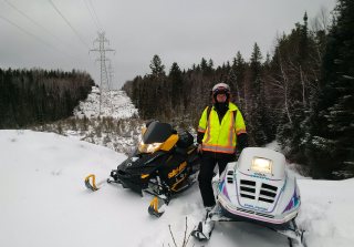
This cross country route starts at the Black Creek road and goes straight south to Wakomata Lake and onward to Tunnel Lake. This is a very challenging run and you may work up a sweat getting unstuck on a few of the hillclimbs. There are several branch-offs along the way for those who wish to shorten up the day. One is at the Seymour Lake road. If you are planning a loop, you can run the powerline down to the Seymour Lake road and sled out at highway 129, provided there is no loggging going on and the road not graded. From there, you can catch the west trail northward back to Black Creek Outfitters.
-

The Sharpsand River Challenge
One of the more challenging parts of the trip is the Sharpsand River. There are two issues to deal with; one is crossing the boulder-infested river and the second is climbing the steep hill on the south side. With respect to the river, the more snow the better as these boulders will easily fill a belly-pan with dents. Directly on the south side of the Sharpsand River is a very steep hill that rises up 220' elevation over a short distance. Calculations have put this at close to 20% over 750 long. If the trail isn't already broken, then send up the studded long-track sleds first.
-

The Roller-Coaster
What would exciting powerline riding be without going up and down steep hills and inclines. There is no shortage of the roller-coaster effect on this route. Although one would expect to need deep snow, we completed it with just 12" to 14" without incident.
Author: Dan Kachur - https://sled-x.ca
